In everyday use, GPS has become a synonym for satellite navigation – yet GPS is only one of several systems grouped under the umbrella term GNSS. For rugged laptops, tablets, and controllers in field use, this distinction makes a practical difference: which system a device uses, how many satellite constellations the receiver can evaluate, and whether RTK correction data is additionally processed determine whether the resulting position accuracy is within several meters or within a few centimeters. This article explains the difference between GPS and GNSS, shows which satellite systems are used in the RobustBook range, what RTK adds on top, what is needed to make it work – and outlines where meter-level accuracy is enough and where centimeter-level accuracy is required.
What Is the Difference Between GPS and GNSS?
GPS stands for Global Positioning System and originally refers exclusively to the satellite navigation system operated by the United States. Because GPS was the first globally available system and remained the best known for decades, the name is often used colloquially as an umbrella term for satellite navigation in general – which is not technically correct. GNSS stands for Global Navigation Satellite System and is the umbrella term for all satellite navigation systems that provide position data globally or regionally, meaning GPS and the further systems described in the next section.
The difference is more than a matter of terminology: a receiver module that supports only GPS can use only the American satellites. A GNSS-capable module, by contrast, can additionally access satellites from other systems and thereby compute with more satellites at once – which makes position determination more stable especially in environments with restricted sky visibility, such as between buildings, under forest cover, or on hillsides. Several devices in the RobustBook range are accordingly equipped not with plain GPS but with GNSS modules that evaluate several constellations at once.
Which Satellite Systems Belong to GNSS?
Alongside the American GPS, GNSS includes the Russian GLONASS, the European Galileo, the Chinese BeiDou, and the Japanese, regionally scoped QZSS. Several RobustBook devices explicitly list in their connectivity specifications which of these systems are supported:
- The RuggON VIKING II 07A and the RuggON SOL 7 are equipped with GNSS covering GPS, GLONASS, Galileo, and BeiDou.
- The RuggON VULCAN 10A lists GNSS with GPS, Galileo, and GLONASS.
- The RuggON VULCAN 10X offers optional GNSS with GPS, Galileo, GLONASS, BeiDou, and QZSS.
- The RuggON VORTEX 07X offers optional GNSS with GPS, Galileo, GLONASS, BeiDou, and QZSS – complemented by dead reckoning or RTK as an option.
- The Fieldbook N101 offers GNSS as an expansion slot option alongside LoRa, AV-IN, CAN, and UART – here satellite navigation can be added modularly instead of being permanently built in.
How many constellations a receiver can evaluate has a direct effect on the reliability of position determination: the more satellites from more systems are visible at once, the more stably position calculation works even with partially obstructed sky visibility.
How Accurate Is an Ordinary GNSS Receiver?
A commercially available GNSS receiver, as installed in tablets and laptops, computes its own position from the differences in signal travel time from several satellites. Without additional correction data, the achievable accuracy is typically within a range of several meters – sufficient for navigation, determining location in the field, routing to the next job site, or roughly assigning a data record to a position. How accurate the position determination turns out in a given case depends on several factors: the number of visible satellites, their geometric distribution across the sky, obstruction by buildings, vegetation, or terrain, and interference effects such as multipath propagation, meaning the reflection of signals off surfaces. For the vast majority of applications in field and construction-site use – such as navigation, tracking vehicles or mobile teams, or roughly georeferencing photos and documentation – this meter-level accuracy is sufficient.
What Does RTK Add on Top?
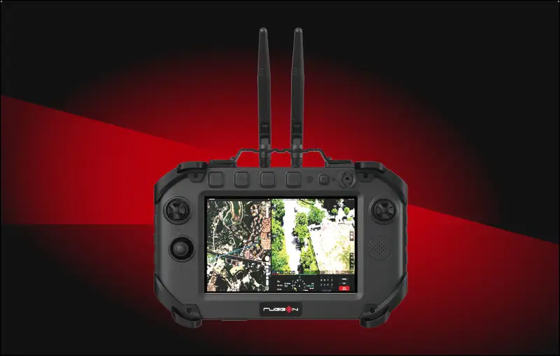
RTK stands for Real Time Kinematic and is a method that improves the position accuracy of a GNSS receiver from several meters down to the centimeter range. Instead of relying solely on satellite signals, an RTK-capable receiver reconciles its measurement in real time with correction data from a known reference position. Because the reference's position is known exactly, signal and atmospheric errors that remain present in a standalone satellite measurement can be calculated out. The result is a significantly more precise position determination, of the kind needed, for example, to control unmanned systems: the RuggON SPARK 7 GSS RTK Android 14 Flight Controller already carries RTK in its name and, according to the manufacturer's description, is a rugged ground station for the precise control of unmanned systems (UAV/UGV), equipped with dedicated GNSS. The RuggON VORTEX 07X also explicitly lists RTK as a supported option.
What Does RTK Require in Practice?
RTK does not work from the receiver alone; it needs a source of correction data. There are essentially two ways to get this: a dedicated reference or base station that stands on a precisely surveyed point and continuously sends its own deviations to the moving receiver – the "rover" – or a correction service that provides correction data from a network of reference stations over the cellular network. In both cases, the receiver needs an ongoing data connection to receive the correction data in real time – usually via radio with a dedicated base station, or via a cellular connection with a correction service. Without this connection, an RTK-capable device falls back to regular GNSS accuracy in the meter range. That is exactly why connectivity – whether via radio antenna or cellular – is an integral part of any RTK setup, not just an accessory detail.
Dedicated GPS or a GPS-LTE Combo: The Connectivity Options in the RobustBook Range
On several Durabook models in the range, the GPS equipment can be chosen during configuration – and there is an important exclusion here that prospective buyers should know about. For the Durabook R8 (including the R8-EX variant) and the Durabook R11 as well as the Durabook R11L, the configurator offers two mutually exclusive options: either a "Multi-Carrier 4G LTE Mobile Broadband + GPS combo," in which cellular and GPS run together through one module, or "Dedicated GPS," a standalone module responsible solely for GPS. Anyone who needs cellular and GPS at the same time chooses the combo option on these models; anyone who needs only GPS without a cellular module chooses the dedicated variant. A combination of both is not offered for these models according to the configurator.
On the Durabook U11I, the equipment is structured differently: dedicated GPS can be selected on its own, but according to the configurator it can additionally be combined with 4G LTE or 5G cellular via an RF pass-through antenna – no documented exclusion like the one for the R8 or R11 is listed for the U11I. It is similar on the Durabook S14I: there, dedicated GPS is available both on its own and in combination with 4G LTE or 5G cellular plus an RF pass-through antenna. On the Durabook Z14I, dedicated GPS is part of the equipment list, complemented by an RF pass-through connector for WWAN, GPS, and WLAN. On the Durabook S15AB, GPS is permanently integrated according to the product description – the optional 4G LTE module can additionally be ordered independently of that.
In practice, that means: anyone ordering GPS as part of a Durabook device's configuration should clarify beforehand whether a cellular connection is also needed at the same time – because not every combination is possible on every model. A complete overview of the GPS/LTE row for each model is provided by the Laptop Comparison Table and the Tablet Comparison Table.
Where Is Meter-Level Accuracy Enough – and Where Are Centimeters Needed?
Not every application needs the same accuracy. The following three examples from field and construction-site use show where meter-level accuracy is enough and where RTK support becomes worthwhile.
Surveying and Measurement
For surveying land, structures, or pipeline routes, as well as for measurement work on a construction site, the standard accuracy of a GNSS receiver is usually not enough – here every centimeter counts, because deviations feed directly into plans, quantity calculations, and billing. Accordingly, the manufacturer's description of the Durabook R11 explicitly mentions "technicians and surveyors" who need access to real-time data out in the field, complemented by GPS and 4G LTE connectivity. For tasks where centimeter accuracy is genuinely required, the RTK correction described in the previous sections is additionally needed, for example via an RTK-capable auxiliary device such as the RuggON VORTEX 07X. The industry page Construction features rugged tablets and laptops configured with an optional LTE/GPS module for use on construction sites.
Precision Agriculture
In agriculture, satellite-based steering has long been established: the industry page Forestry and Agriculture describes that GPS-guided tractors have been gaining popularity for years and can be implemented in the field with rugged RobustBook tablets. For simple auto-steering in the field or documenting the areas worked, meter-level accuracy is often enough. If, on the other hand, driving passes need to line up exactly to avoid overlaps or gaps in seeding, fertilizing, or harvesting – precision agriculture in the strict sense – the significantly higher accuracy delivered by RTK correction methods is needed.
Drone and Flight Control (UAV/UGV)
The need for centimeter accuracy shows up most clearly in the control of unmanned systems: the RuggON SPARK 7 GSS RTK Android 14 Flight Controller already carries the RTK reference in its name and is explicitly designed as a ground station for UAV/UGV with dedicated GNSS – featuring two Hall-effect joysticks and programmable buttons for mission control. In addition, the Durabook GC-R8 offers a rugged ground control station with a Hall-effect joystick, a 5-way control pad, and Flip-Guard-protected buttons for operating unmanned systems, designed for integration with the Durabook R8 tablet.
GPS, GNSS, and RTK in the RobustBook Range – an Overview
In summary, the range offers three equipment tiers: plain or dedicated GPS as a standalone module, GNSS modules with several satellite constellations for more stable position determination, and – on selected ground stations and panel devices – additional RTK support for centimeter accuracy. Which equipment a given model carries depends on the device class: for the Durabook tablets and laptops, the choice is mostly between dedicated GPS and a GPS-LTE combination, while the RuggON ground stations and panel PCs are designed with several satellite systems and optional RTK support for controlling unmanned systems. Anyone wanting to configure a specific device will find the complete, verified equipment list on the respective product page as well as in the Tablet Comparison Table.
Frequently Asked Questions
Is GPS the same as GNSS?
No. GPS is the American satellite system and thus only one of several. GNSS is the overarching umbrella term for all satellite navigation systems, including GPS, GLONASS, Galileo, BeiDou, and QZSS.
Is an ordinary GPS receiver enough for surveying?
Usually not. A commercially available receiver typically achieves meter-range accuracy without correction data. For surveying and measurement work where centimeter accuracy is required, RTK correction data is additionally needed.
What is specifically needed for RTK?
An RTK-capable receiver plus an ongoing source of correction data – either a dedicated base station with a radio link to the rover, or a correction service that delivers the data over the cellular network.
Can I order GPS and LTE at the same time on every RobustBook device?
Not on every model. On the Durabook R8, R8-EX, R11, and R11L, "Dedicated GPS" and the "4G LTE + GPS combo" are mutually exclusive according to the configurator. On the Durabook U11I and S14I, on the other hand, dedicated GPS and cellular can be combined.
Which devices in the range support RTK?
The RuggON SPARK 7 GSS RTK Android 14 Flight Controller already carries RTK in its product name and is designed as a ground station for UAV/UGV. The RuggON VORTEX 07X also explicitly lists RTK as a supported option.
When GPS Is Enough and When RTK Is Needed
GPS is a single satellite system, GNSS is the umbrella term for all comparable systems worldwide – GPS, GLONASS, Galileo, BeiDou, and QZSS. An ordinary GNSS receiver typically achieves meter-range accuracy without additional correction data, sufficient for navigation, tracking, and rough georeferencing. RTK improves this accuracy to the centimeter range but requires an ongoing connection to a base station or a correction service for that. In the RobustBook range, the spectrum runs from dedicated GPS through multi-system-capable GNSS modules to RTK-capable ground stations such as the RuggON SPARK 7 GSS RTK Android 14 Flight Controller – which equipment fits depends on the specific application, from simple location determination in the field to centimeter-accurate control of unmanned systems.
If you have questions about the right GPS, GNSS, or RTK equipment for your specific application, the RobustBook team is happy to help you choose the suitable model.